
Ficheiro:Connecticut Presidential Election Results 2016.svg

Dimensões desta antevisão em PNG do ficheiro SVG: 156 × 127 píxeis Outras resoluções: 295 × 240 píxeis | 590 × 480 píxeis | 943 × 768 píxeis | 1 258 × 1 024 píxeis | 2 516 × 2 048 píxeis.
Ficheiro original (ficheiro SVG, de 156 × 127 píxeis, tamanho: 5 kB)
| Este ficheiro vem do Wikimedia Commons e pode ser usado por outros projetos. Sua página de descrição é reproduzida abaixo. O Commons é um repositório de ficheiros sob licença livre. Saiba como ajudar. |
Descrição do ficheiro
| Descrição |
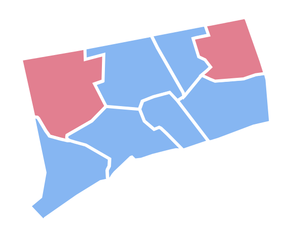
English: Connecticut Presidential Election Results 2016 |
| Data | |
| Origem | Obra do próprio |
| Autor | Ali Zifan |
Licenciamento
Eu, titular dos direitos de autor desta obra, publico-a com a seguinte licença:
A utilização deste ficheiro é regulada nos termos da licença Creative Commons Atribuição-CompartilhaIgual 4.0 Internacional.
- Pode:
- partilhar – copiar, distribuir e transmitir a obra
- recombinar – criar obras derivadas
- De acordo com as seguintes condições:
- atribuição – Tem de fazer a devida atribuição da autoria, fornecer uma hiperligação para a licença e indicar se foram feitas alterações. Pode fazê-lo de qualquer forma razoável, mas não de forma a sugerir que o licenciador o apoia ou subscreve o seu uso da obra.
- partilha nos termos da mesma licença – Se remisturar, transformar ou ampliar o conteúdo, tem de distribuir as suas contribuições com a mesma licença ou uma licença compatível com a original.
Histórico do ficheiro
Clique uma data e hora para ver o ficheiro tal como ele se encontrava nessa altura.
| Data e hora | Miniatura | Dimensões | Utilizador | Comentário | |
|---|---|---|---|---|---|
| atual | 22h08min de 20 de fevereiro de 2017 | | 156 × 127 (5 kB) | PalmerTheGolfer | Reverted to version as of 21:01, 15 January 2017 (UTC) I'm just saying, there is no need for idiosyncratic county lines to be included while this map is : Not inaccurate, conforms to previous maps. |
| 22h08min de 20 de fevereiro de 2017 |  | 156 × 127 (5 kB) | PalmerTheGolfer | Reverted to version as of 21:01, 15 January 2017 (UTC) I'm just saying, there is no need for idiosyncratic county lines to be included while this map is : Not inaccurate, conforms to previous maps. | |
| 01h31min de 16 de janeiro de 2017 |  | 156 × 127 (9 kB) | Kingofthedead | Yes, however, there is no reason for consistency when this map form outlines the state more accurately than the previous one. | |
| 21h01min de 15 de janeiro de 2017 |  | 156 × 127 (5 kB) | PalmerTheGolfer | Reverted to version as of 23:20, 9 November 2016 (UTC) While the current map may describe the idiosyncrasies of CT's counties more accurately, the form of the map does not conform to previous map forms, such as lining, as plenty of other states do not... | |
| 19h37min de 28 de dezembro de 2016 |  | 156 × 127 (9 kB) | Kingofthedead | Reverted to version as of 05:52, 23 December 2016 (UTC) This map is not "tough to see" and is far more accurate. | |
| 02h42min de 27 de dezembro de 2016 |  | 156 × 127 (6 kB) | PalmerTheGolfer | Reverted to version as of 03:24, 22 December 2016 (UTC) Why have a more rigid, tough to see map? | |
| 05h52min de 23 de dezembro de 2016 |  | 156 × 127 (9 kB) | Kingofthedead | Reverted to version as of 18:43, 18 December 2016 (UTC) | |
| 03h24min de 22 de dezembro de 2016 |  | 156 × 127 (6 kB) | PalmerTheGolfer | Reverted to version as of 19:12, 17 December 2016 (UTC) No need to make State more rigid, as previous elections have different maps | |
| 18h43min de 18 de dezembro de 2016 |  | 156 × 127 (9 kB) | WikiBunny2K1 | Update shape | |
| 19h12min de 17 de dezembro de 2016 |  | 156 × 127 (6 kB) | WikiBunny2K1 | Rotate |
Utilização local do ficheiro
A seguinte página usa este ficheiro:
Utilização global do ficheiro
As seguintes wikis usam este ficheiro:
- Uso no domínio fr.wikinews.org
- Uso no domínio simple.wikipedia.org